Towns
The Tøndermarsken towns offer a wealth of experiences. They each have unique architecture and interesting history. Each of the four towns bears unique hallmarks of the special conditions that apply to life in the marshes.

TØNDER
Tønder lies on the edge of the inner marsh. Tønder was once a harbour and market town. It received its charter in 1243 and is therefore one of Denmark’s oldest market towns. Ever since the middle ages, the town has been the trading and administrative centre of the marshes. Tønder is low-lying and was repeatedly flooded by storms and heavy rainfall. In the 16th century, the inhabitants built the first dykes to protect the town from flooding. The dykes isolated Tønder from the sea and the town was therefore no longer a harbour town. Today, “Det fremskudte Dige (the forward dyke)”, built in 1981, protects the town.
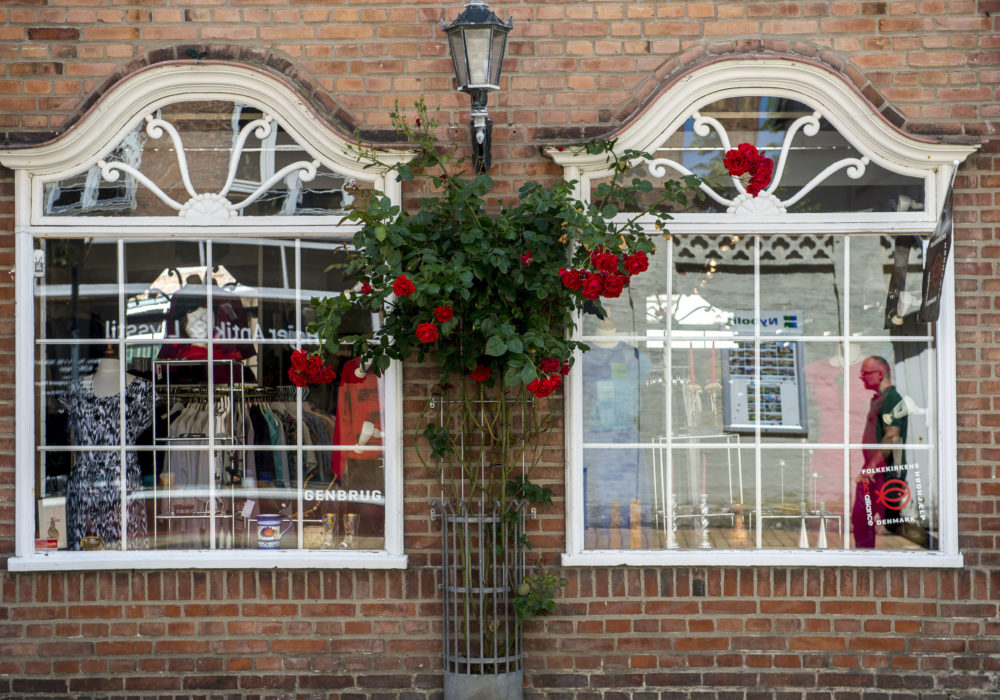
The town has beautiful, historical architecture and there are many richly decorated doors. The fine buildings were built for local merchants whose trading with bobbin lace and bullocks brought affluence to the town. Check out “Digegrevens Hus (the Dyke Master’s House)” on the pedestrian high street and the houses in Uldgade (parallel with the pedestrian high street). The ancient houses of artisans and the bourgeoisie along the cobblestoned street make Uldgade one of Tønder’s prettiest streets.
Tønder Church on the main square is well worth a visit. The church is one of the most spectacularly decorated Renaissance churches in Denmark. Beside the church, you can find Hans J. Wegner’s childhood home. Tønder Water Tower houses Denmark’s only permanent exhibition of Wegner’s work.

HØJER
Højer lies on a plateau at the edge of the marshes behind the outermost dykes. From here, there are views over the wet, low-lying marshes to the south and west. Højer was founded in the middle ages and, from an early stage, it was a port of call for merchant ships and oyster fishermen. In 1736, Højer was large enough to be designated a flække, i.e. a community entitled to trade and engage in crafts, although Højer was less important than Tønder, which was a købstad (market town). When Højer Dyke and Sluice were constructed in 1861, a harbour was built to the west of the sluice. There are several large farm properties at the centre of Højer. Højer’s farmers bred bullocks in the marsh to the south of the town.
Højer Mølle Windmill
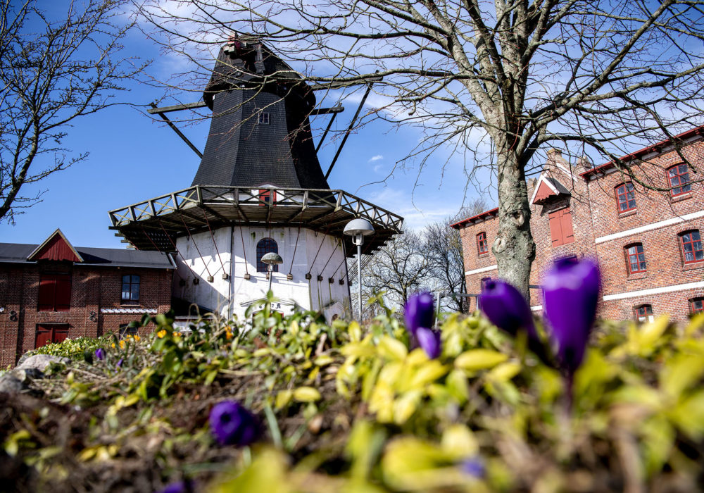
Højer Mølle is one of Europe’s largest Dutch windmills. Emil Roll, a miller and corn merchant, erected it in 1857. Roll also built the miller’s house and garden. As his business flourished, he later built both grain storage barns. From the mill, there is a great view over Tøndermarsken and the Wadden Sea.
Oysters in Højer
People have harvested oysters from the Wadden Sea since medieval times. From 1759, the oyster harvest was based at the oyster storehouse at Kiers Gaard in Højer. Oysters were a luxury food, exported from Højer even as far afield as to the court of the Russian Empress, Catherine the Great. The European oyster was wiped out by disease in the 1920s. The Pacific oyster has spread since the 1990s and has formed new oyster colonies in the Wadden Sea.

RUDBØL
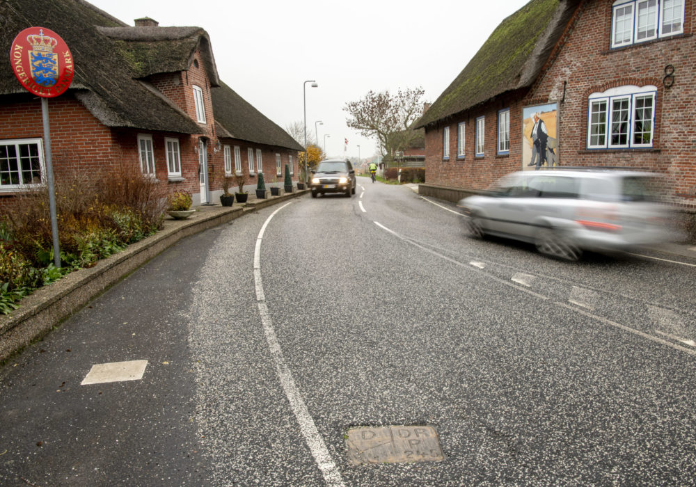
The current Danish-German border has run through the centre of Rudbøl since 1920. The village is famous for its boundary stones – set in the centre of the main road through Rudbøl. The houses on one side of the road are in Denmark while the houses on the other side are in Germany.
A community of bådfolk (fishermen) lived in Rudbøl and Gudskogen south of the border until drainage projects in the 1920s dried out the wetlands of the marsh. Drainage work eradicated a culture in which people sailed, fished and harvested reeds. The boggy landscape remains a rich habitat for birds, and Rudbøl attracts many visitors who come to see the starlings black out the sun in this area.
Rudbøl was founded in the middle ages on a sand bank in the Vidå Stream. The sand bank was artificially raised to create dwelling mounds called værfter that were later incorporated into the large sea dyke constructed by Duke Hans the Older between 1554 and 1556. Even today, Rudbøl follows the contours of the top of the dyke. Rudbøl and Nørremølle are the only rural villages in Denmark built on dykes.

MØGELTØNDER
Møgeltønder is the marsh’s beautiful and well-preserved castle town. In the middle ages, Møgeltønder was a village with a fortress on the perimeter of the marsh. Nobleman Hans Schack acquired both village and fortress in 1661. He tore down the fortress and built Schackenborg Castle. In Møgeltønder, in addition to Schackenborg Castle, you can visit Slotsgaden, a cobblestoned avenue lined with linden trees. Slotsgaden is often described a “Denmark’s prettiest rural street”. The town has elegant, thatched, red brick houses with small bay windows and beautiful front doors. The houses date from the 1700s.
The Slotfelt Barn
Do not forget to drop by Slotfelt, a very special thatched barn to the south of Møgeltønder. It dates from the 1870s. The Slotfelt Barn is one of Tøndermarsken’s most imposing buildings. It belongs to the Schackenborg estate. It was built in the mid-1800s to store hay harvested in the marshes. The barn was in use until 2008. It recently underwent major restoration work to recreate its large, breath-taking thatched roof.
Sødamgaard
Farther out in the marshes, there is a row of farms on værfter (dwelling mounds), collectively known as Ved Åen (By the Stream). Along with large expanses of the marshes, these farms originally belonged to Schackenborg manor. Most of the Tøndermarsken dwelling mounds date back to the 14th and 15th centuries. At that time, a higher sea level and severe storms forced the marsh population to elevate the sand banks they lived on. Most of the surviving bank farms were built in the 18th and 19th centuries of red brick with large thatched roofs. Sødamgaard is one of the bank farms in the Ved Åen area.

UBJERG
Ubjerg is well worth a visit. It is the only complete dwelling mound village. It has a church, parsonage and school surrounded by bank farms. Ubjerg was built in the middle ages on a tongue of sand that nature had formed on the marshes between two streams, Vidå and Sønderå. Freely translated, Ubjerg means “outer mound”. In time, the risk of inundation increased. The people of Ubjerg raised the tongue of sand, building dwelling mounds to elevate their homes. The church inventory dates from the Middle Ages and bears witness to an affluent community in the area. The ceiling frescos depict the Garden of Eden – a notable motif. The well-preserved parsonage from 1675 is one of Denmark’s oldest.